Click on streets in white below to view Nags Head beach access
Some streets only have boardwalks and dune deck walkovers.
(These have no links, but are shown below for their location).
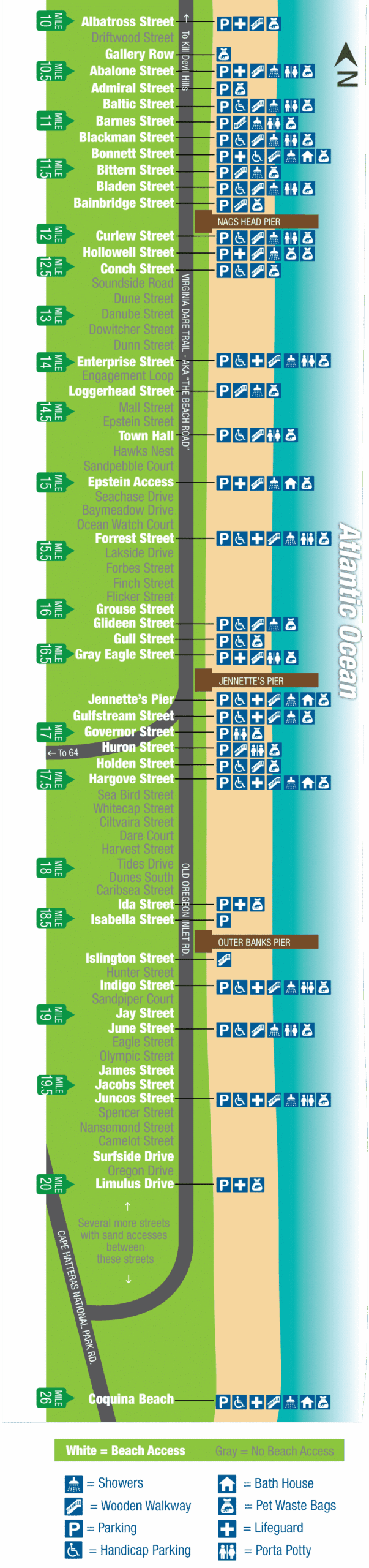
Information and access amenities may change • Map is not to scale.
About Nags Head
Not long ago, all you had to say when driving to the Outer Banks was that you were going to “Nags Head” and that meant you were heading to any and every beach or town you could reach by driving across the three-mile long Wright Memorial Bridge. Nags Head was the hub of activity whether you were traveling the beach road (also known as NC-12 or Virginia Dare Trail) or the bypass (also known as US 158).
Once again, Nags Head has been a trend-setter and started beach replenishment at several of its narrowest beaches several years ago. The refurbished sand supply has created wide – and super-wide – stretches of sand in some parts of Nags Head. There will be no need to wonder if the high-tide line is going to interfere with your beach umbrella’s stake!
Why Nags Head? People come for the authentic feel of vacationing in Old Nags Head row where historic shingled cottages from the early 1900s bring back memories of how this area became famous, but they stay for the convenient beach access and family-friendly stretches of sand.
Use our map of Nags Head beach access points to find every convenience and amenity to make your day at the beach simple. Use the symbols to locate bath houses, lifeguard stands, handicap parking lots, showers, and pet-friendly beaches.
Nags Head Beach Access Locations – With Photos (listed from north to south):
Parking Tip: During the busy season, most parking fills up quickly, usually by 10-11am.